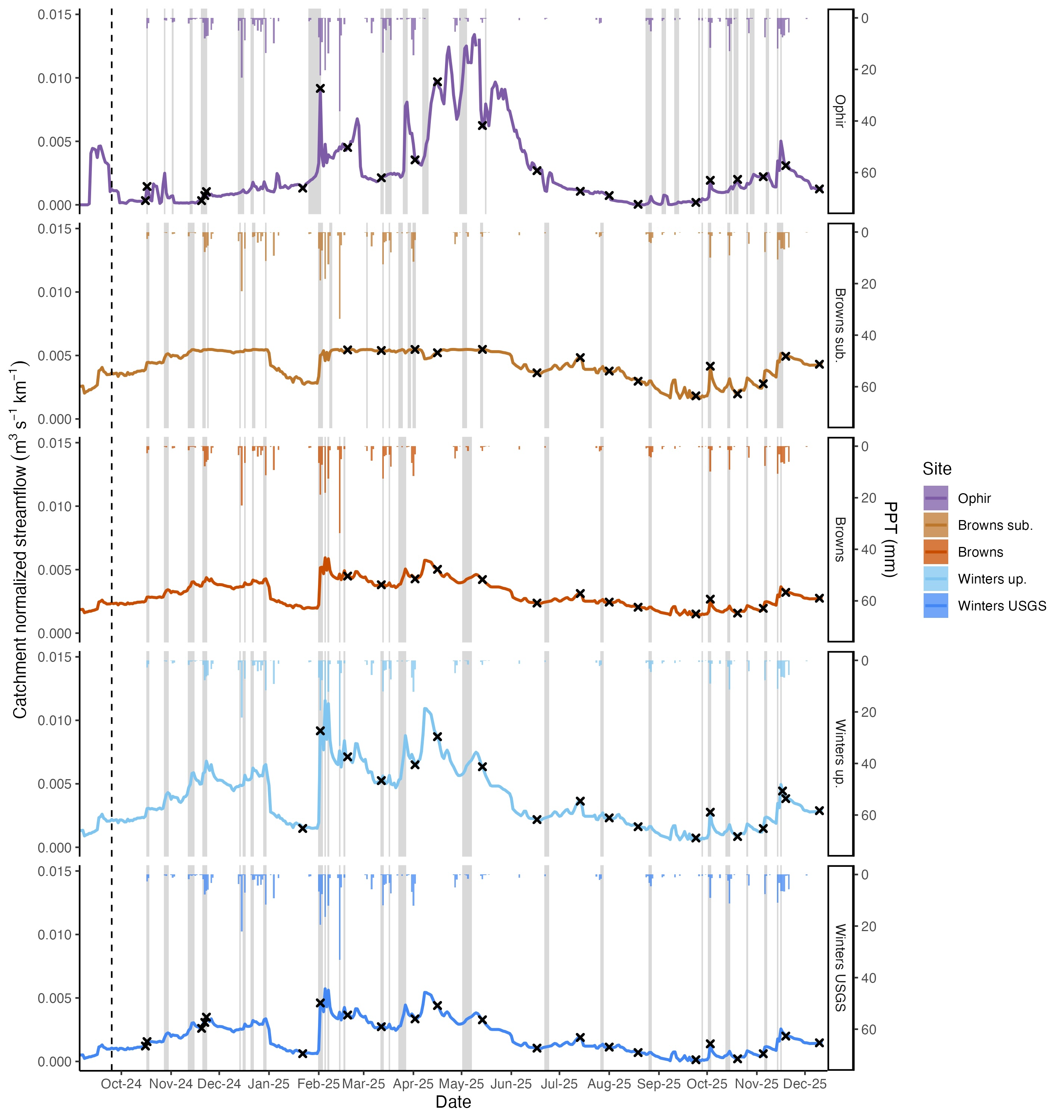
Concetration discharge dynamics following the Davis Fire
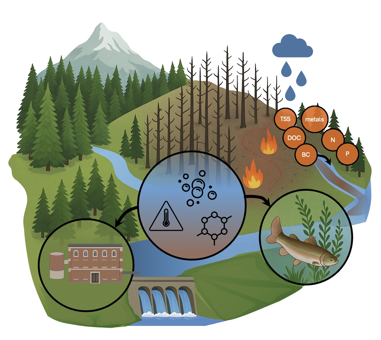
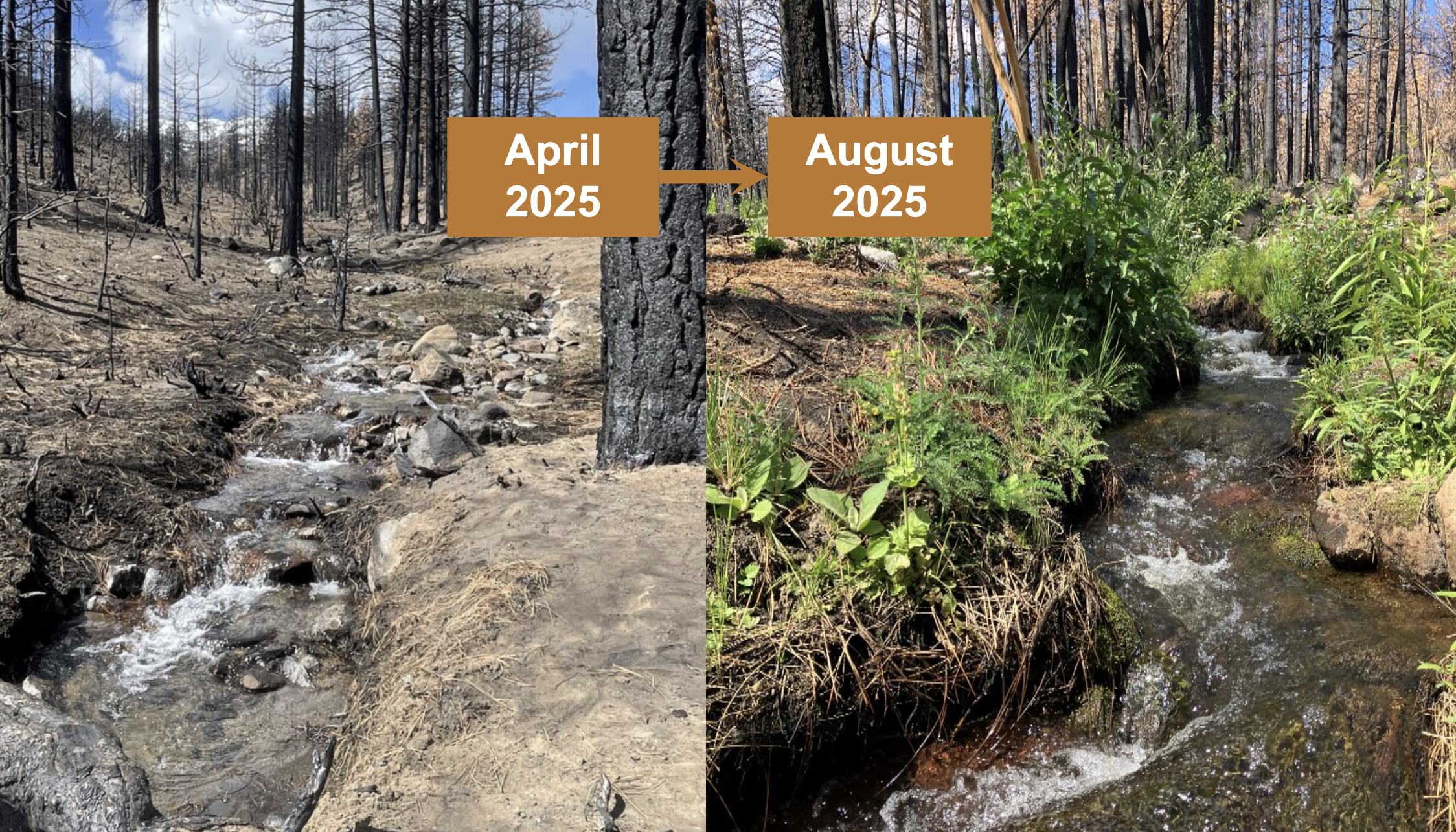
Wildfires strongly change the chemical and physical processes that control how streams move nutrients, metals, sediment, water, and heat. These changes affect water quality and ultimately alter aquatic ecosystems by changing the amount and composition of algae and aquatic insect communities that live in the stream. Conditions during the first storms are expected to strongly impact streams; however, some solute and ecological changes can take years to appear. Because of this, both short-term event monitoring and long-term monitoring are needed to guide restoration and support ecosystem recovery after wildfire.
Here, we present water quality responses from stream networks affected by the Davis Fire in the Washoe Valley south of Reno, Nevada, USA. The fire burned 23.5 km² of private, state, and federal land, including pinyon–juniper woodlands and conifer forests, for 18 days before containment in September 2024. We begin monitoring water quality in October 2024 across four catchments that span a range of flow conditions, from perennial to intermittent streams. We focus on the first storm event after the fire, which quickly flushes ash, nutrients, and contaminants from burned areas into nearby streams. By combining event-based sampling with baseline data, we intend to capture both immediate impacts and ongoing changes across different burn severities and levels of stream connectivity.
Preliminary data for this project is available here (Link) Please contact us before using.
Co-authors: Will Larsen, Kailong, Li, Jodi Ryder, Brittany Kruger, Mark Hausner, Monica Arienzo
This work was supported by U.S. Army Engineer Research and Development Center Cooperative Agreement W912HZ-23-2-0025. Special thanks to Microplastics and Environmental Chemistry Lab technicians Sabbathiel Greene, Marin Monteith, and Luisa Ortega for their help with data collection and processing.
See our groups DRI (Link) for more information about the lab.